
One of my favorite trails when it’s raining out is the San Juan Trail. Eleven miles of singletrack through the Santa Ana Mountains, completely off-grid, no cell service.
For almost two years, I haven’t been able to use it. The trail and a large portion of the surrounding Cleveland National Forest have been closed under a standing order from OC Health and Services tied to the September 2024 Airport Fire. As far as I can find, it has no published end date. The filing from .gov points to .info a non government website, and if you look at the URL its categorized with COVID which is also strange
The closure covers a significant area beyond what was burned
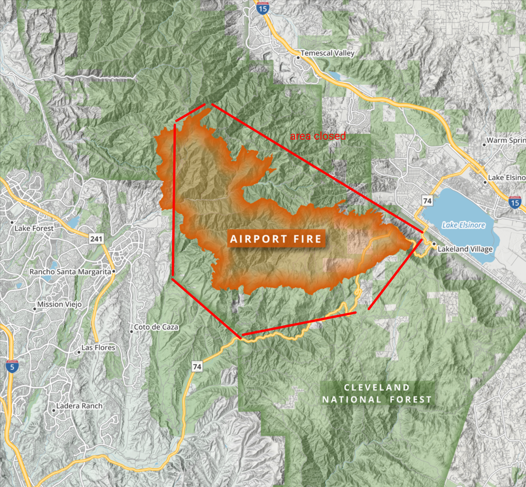
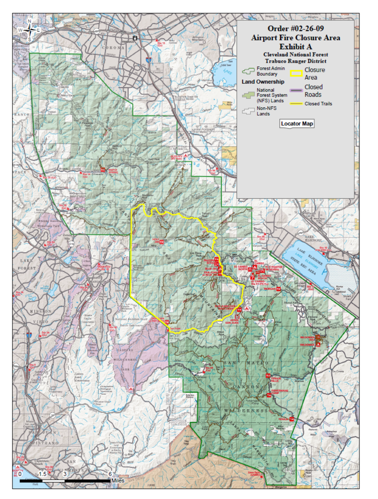
What’s hard to square
Other Southern California fires — many of which started after the Airport Fire, in terrain with worse hazards and more burn severity — have already reopened:
- Palisades fire
- Eaton Fire
- The Garden Grove Toxic warehouse fire
If those areas are safe enough, the difference is worth explaining.
What I want answered
Two years is too long to lock up public land without a line-item explanation:
Why no public timeline? Other post-fire reopenings have come with staged dates. This one hasn’t.
What, exactly, makes this footprint unsafe?
What has to change for the closure to end? A remediation milestone? A soil threshold? A cleanup target?